Clarification of Question by
mharoks-ga
on
13 Feb 2005 19:30 PST
Thanks for the comments, pafalafa and sqylogin!
These appear to be a good start, but a little more is needed to
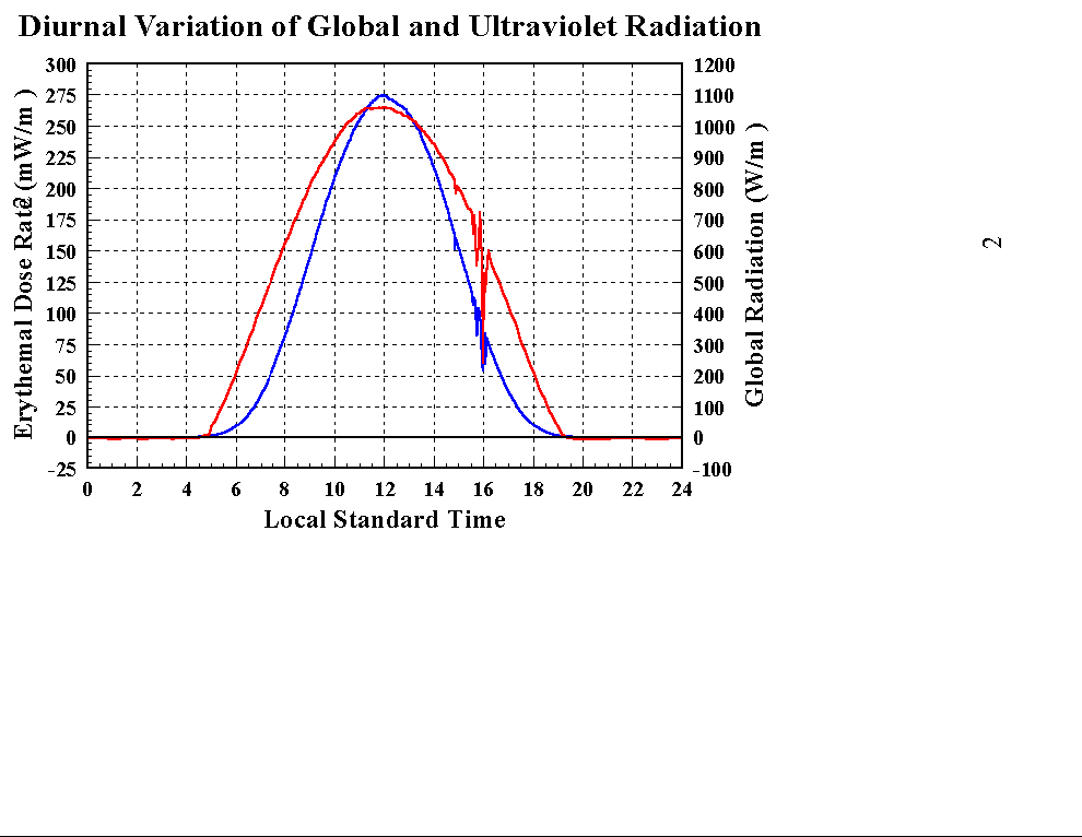
address my question. The chart identified by pafalafa does a nice job
of showing the variation in intensity during a single day (and the
information it contains could easily be converted into a 0-100 scale
by the researcher). However, I'll also want to compare this
information across seasons. Thus, for example, I'd want to know what
the intensity would be in the middle of winter (on a 100-point scale).
Thus, for example, if the worst day in summer at midday is 100, I want
to know not only what the value would be at various hours on that day
(values every hour or two would be ideal), but also for different
months (preferably every 2-3 months, if not monthly). I would have
thought that this distribution was fairly similar across days and
different locations (though, obviously, the amount of UV exposure will
vary by location), but perhaps that is not true. The researcher can
give the data for the state of Minnesota, although ideally I'd like to
know if the variation really changes by state/country (e.g., wouldn't
the same distribution hold for New Zealand?). Information about how
this varies due to different levels of cloud cover will earn a bonus.
Thanks a lot!
mharoks